Archive

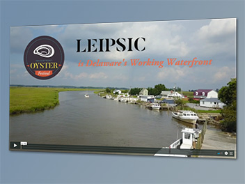
Story maps can use a combination of interactive maps, photos, videos and links to provide spatial information in a visually appealing, reader-friendly way. Lee Ann has produced several story maps, including these two for Laurel. The first uses the new cascading template to produce full-frame...

While working with communities, Lee Ann realized the benefit of using drone photography to help tell the story of a place. She purchased a DJI Mavic Pro drone with 4K capability and studied for and passed the FAA unmanned aircraft systems (UAS) exam to become...

[caption id="attachment_1104" align="alignright" width="300"] An advisory team helped develop guiding principles for the Town of Laurel's 10-year comprehensive plan.[/caption] Laurel's updated 10-year comprehensive plan was approved by the Mayor and Council in October 2017. Cedar Creek Planners prepared the draft and final plan over two years. Lee...

Empowering communities to tell their stories, Lee Ann shoots and produces videos. "Paddling Broad Creek" promotes nature and heritage tourism in and around Laurel, Delaware. "Reimagine Laurel" was an effort to sell the town to the producers of the HGTV show, "Home Town," for a...

In August 2016, former Governor Markell designated Laurel's core commercial and historic area as a Downtown Development District. Cedar Creek Planners prepared the town's application. [caption id="attachment_714" align="alignright" width="354"] Laurel's Downtown Development District[/caption] The application is based on need and impact - 50 percent; local incentives -...